For full functionality of this site it is necessary to enable JavaScript. Here are the instructions how to enable JavaScript in your web browser.

Aerial Survey

The intelligent, precise and best value aerial survey and insight solution for plantation management

Advanced solution with comprehensive workflow

Advanced solution with comprehensive workflow

At Insight Robotics, we provide intelligent plantations and agriculture-focused risk management services for precise and early detection of human and natural threats.

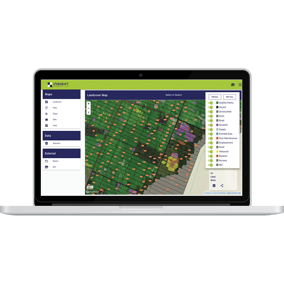
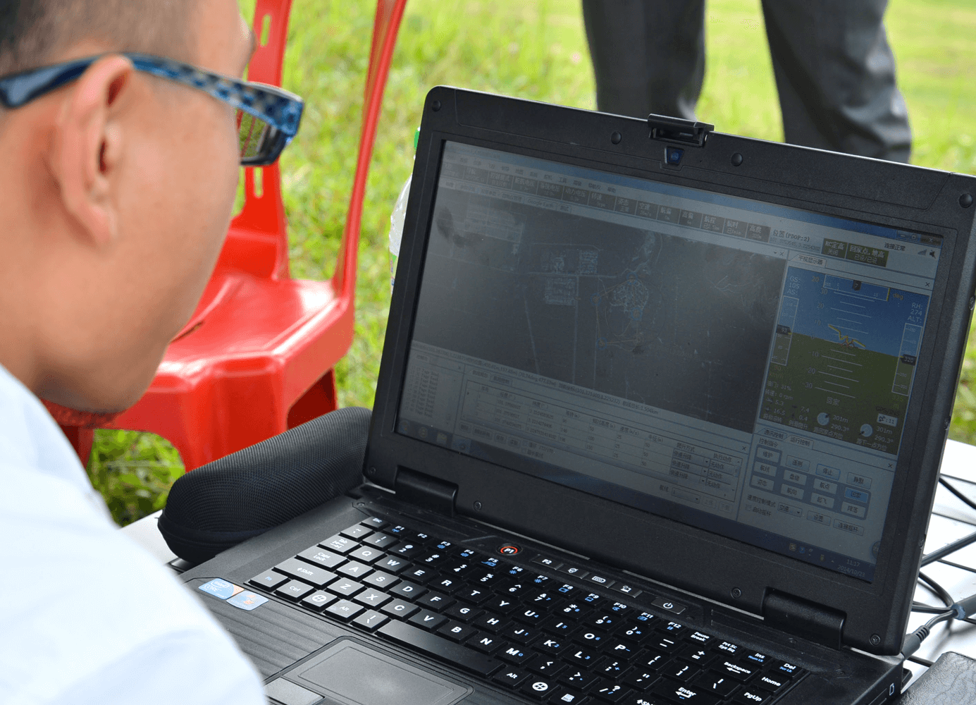
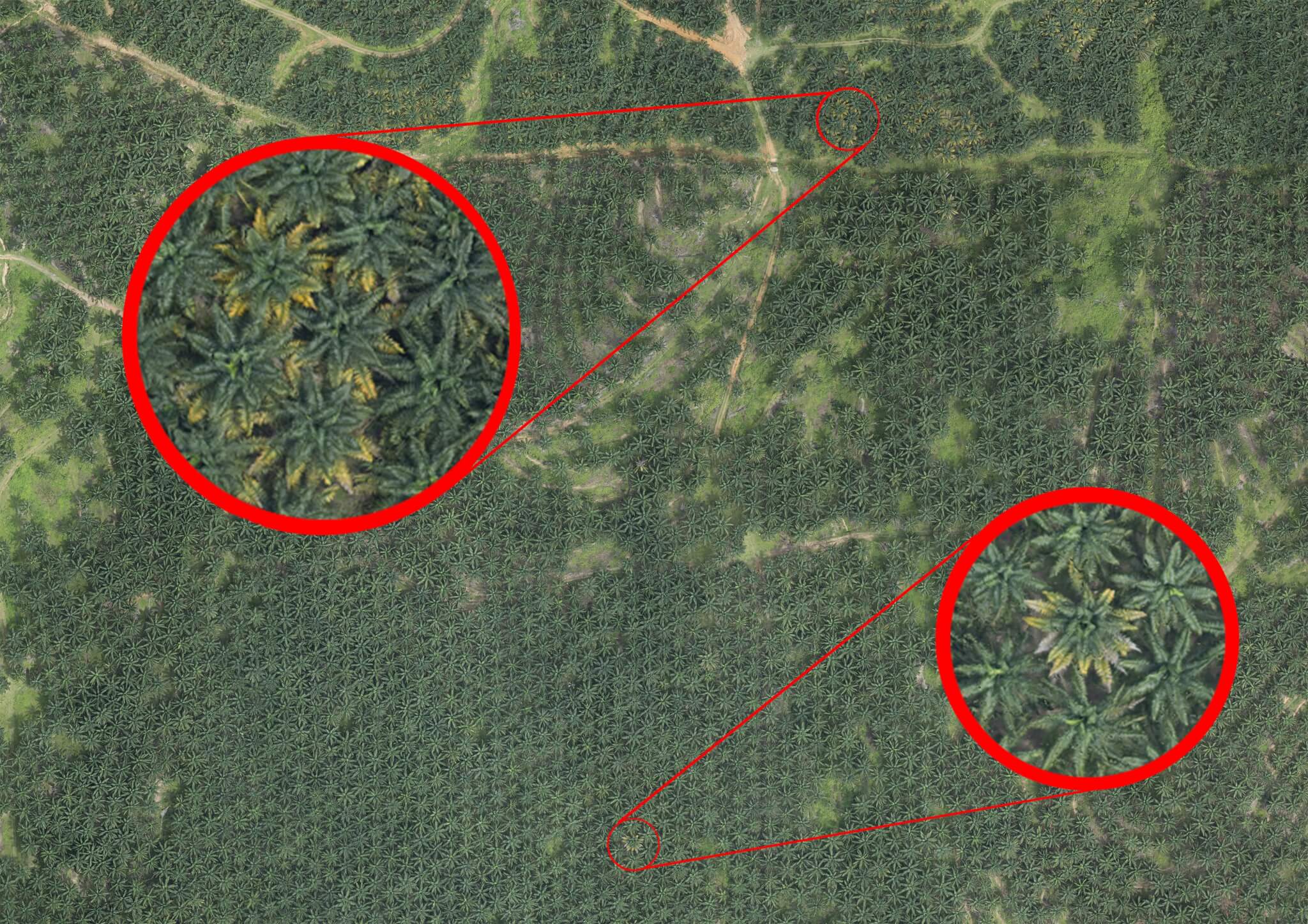
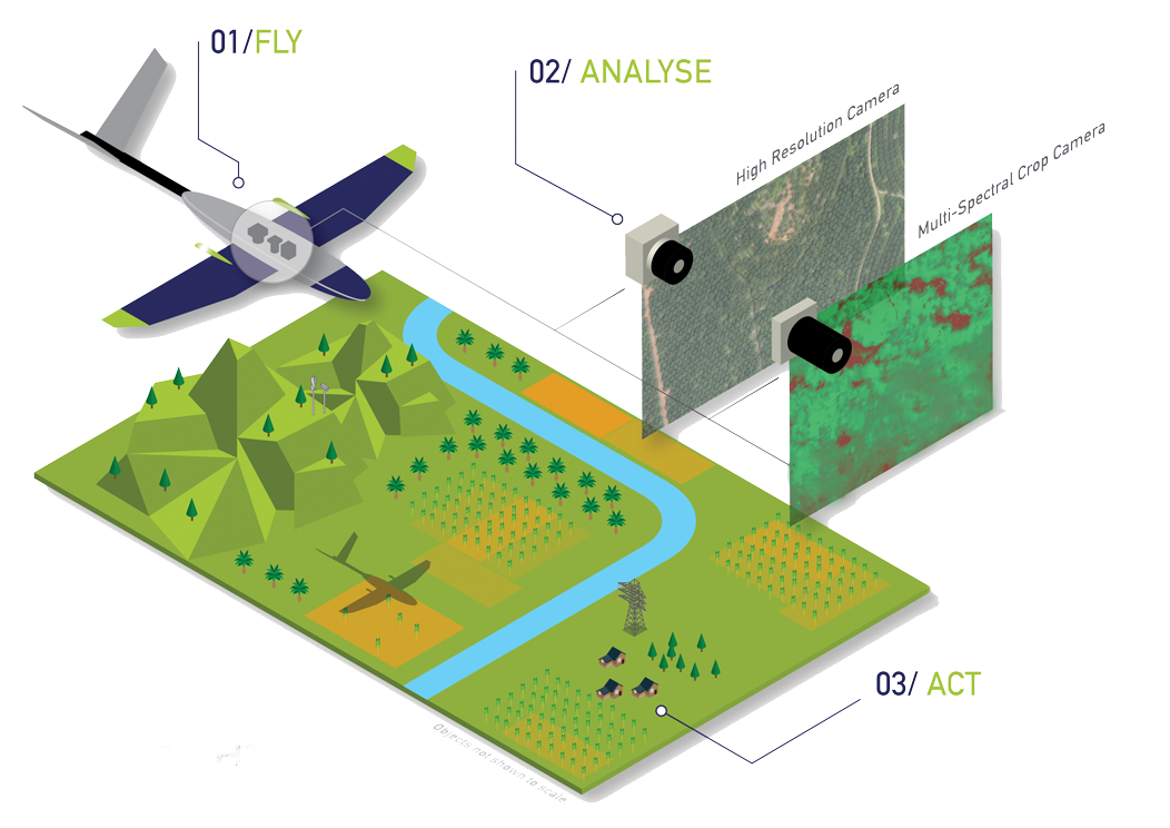
Our purpose-built RGB and multispectral system captures high-resolution terrain mapping and precise aerial assessments. Data will be processed into useful visualizations of large land area. Decision makers can respond to threats and manage land to optimize output.

Digital Measurement for Plantation and Agriculture

Inventory Mapping

Empower you to manage assets efficiently by providing precise and high-resolution terrain mapping and crop assessments, such as down to cm level DOM, landuse mapping, palm census, road & drain network, etc.

Due Diligence

Allow assessment of land potential and suitability prior to acquisition or finance transaction. Captured aerial data can be analyzed with relevant data and Government data to comply with regulations.

Advanced Analytics

Offer specific solution with more advanced analysis such as yield performance and advanced DTM to improve productivity, better road & infrastructure management, and visualization.

Why choose our Aerial Survey services?

Plantation Expert

We have over 10 years of GIS, computer vision experience, and work experience in top tier plantation companies.

Data Accuracy & Precision

We provide best solution with highly accurate data acquisition and precise analysis down to cm level.

Patented Advanced Technologies

In-house developed image processing and object identification technologies lead the industry.

Project Delivery Assurance

We process 10,000 images in parallel per second. Over 1 million ha of lands have been surveyed.

Interactive GIS Visualization Platform: InsightAerial

Visualization

InsightAerial is an easy-to-use cloud-based GIS web portal for visualizing the geospatial data – view mapping data, analysis and statistics within a single click. 

Accessibility

Multiple users can access InsightAerial from any device or location without the inconvenience of large data downloads. InsightAerial works seamlessly across devices whether that be a PC, tablet, or smartphone.

Our cloud-based software enables users to leverage key insights regardless of where they happen to be.

Data sharing

Previously, the difficulty of data sharing between teams has limited plantation owners’ ability to estimate yields, predict threats and plan accordingly.

InsightAerial enables users to easily and rapidly share analytics data between key personnel internally or externally. Decision makers can easily access mapping data, derive smarter insights, identify potential risks and discover new opportunities.

Explore our technology further

Download our comprehensive product brochure and learn how our aerial survey can benefit you. Complete the form and the following document will begin downloading.

Interested in learning more about our Aerial Survey service?

Contact Us

© Insight Robotics 2018. Privacy PolicyTerms of Use and Site Credits